Ho Chi Minh City map: how the city is laid out and how to get around in 2026
Ho Chi Minh City looks chaotic, but the layout is simple: the Saigon River, the tourist core of District 1 on the west bank, and a handful of zones around it. This is a navigation guide — where things sit, how far apart they are, where the new metro runs, and how to set up your maps so you never get lost.
Ho Chi Minh City by area

Prices and distances current as of July 2026. Rough rate used here: 26,000 VND ≈ $1.
- Notre-Dame Cathedral (Nhà thờ Đức Bà Sài Gòn): French Gothic, 1877–1880 — Under restoration since 2017
- Central Post Office (Bưu điện Trung tâm Sài Gòn): Colonial architecture — Antique maps on the walls
- Ben Thanh Market (Chợ Bến Thành): The main anchor of D1 — 06:00–18:00, night market 18:00–23:00
- Reunification Palace (Dinh Độc Lập): Entry 80,000 VND (~$3.10) — 07:00–18:00
- Bitexco Tower (Tháp Tài chính Bitexco): 262 m, riverside landmark — Skydeck 200,000 VND (~$7.70)
- Bui Vien Street (Phố Tây Bùi Viện): Backpacker zone of D1 — Bars, hostels, nightlife
- Nguyen Hue Walking Street (Phố đi bộ Nguyễn Huệ): Central axis of downtown — City Hall down to the river
- War Remnants Museum (Bảo tàng Chứng tích Chiến tranh): On the D1/D3 border — 07:30–17:30
- Jade Emperor Pagoda (Chùa Ngọc Hoàng): North of D1, near the zoo — Taoist temple, free entry
- Binh Tay Market (Chợ Bình Tây): Cholon (D5/D6), to the west — Biggest market in Cholon, built 1928
- Thien Hau Temple (Chùa Bà Thiên Hậu): Cholon, 18th-century temple — Heart of Chinatown
- Landmark 81 (Vincom Landmark 81): 461 m, landmark to the northeast — Visible from almost anywhere
- Saigon Zoo (Thảo Cầm Viên Sài Gòn): North of D1, by the river — Oldest zoo in Vietnam, 1864
- Ben Thanh Metro Station (Ga Bến Thành): Start of Line 1 — Opened December 2024
- District 3 (Quận 3): North-west, adjacent, 2 km — Cafés, War Remnants Museum, quiet
- Cholon (D5) (Chợ Lớn): West, 5 km — Chinatown, Binh Tay Market, food
- Binh Thanh (Quận Bình Thạnh): North, by the river, 4 km — Landmark 81, riverside promenade
- Thao Dien (D2) (Thảo Điền): East, across the river, 7 km — Expat cafés, coworking spaces
- District 4 (Quận 4): South, over the bridge, 2 km — Seafood, street food
- D7 (Phu My Hung) (Quận 7): Far south, 10 km — Malls, parks, expat community
How Ho Chi Minh City is laid out, in a nutshell

Start with one thing: the Saigon River is the spine of the city. It curves roughly north to south, and almost everything you came for sits on its west bank. The east bank is Thao Dien and the newer Thu Duc districts — worth crossing for the expat cafés, not much else on a short trip.
Second: the centre is District 1 (D1). Measure everything else from here. Keep this simple compass in your head, all relative to D1:
- D1 — the centre. Ben Thanh Market, Notre-Dame Cathedral, the Bitexco riverfront. This is where you will spend most of your time.
- District 3 — northwest, right up against D1. Quiet boulevards, cafés, the War Remnants Museum.
- Cholon (D5, partly D6) — west, 5 km out. Chinatown, Binh Tay Market, temples.
- Binh Thanh — north, 4 km. Landmark 81 stands on the riverfront here — visible from nearly everywhere, so it doubles as a beacon.
- Thao Dien (formerly D2) — east, across the river, 7 km. The expat hub.
- D4 — south, just over the bridge. Small, food-focused.
- D7 / Phu My Hung — far south, 10 km. Family-friendly, expat.
- Airport (Tan Binh) — northwest, 7–8 km from the centre, right inside the city.
Third, and the key point for a short trip: you will be in D1 almost the whole time. The landmarks, restaurants, bars, hotels and tour pickup points are all here. The other districts are deliberate outings — food in Cholon, photos at Landmark 81, a calm coffee in Thao Dien.
The centre: how District 1 works

The tourist part of District 1 is roughly 8 km², and the essentials fit inside a 2×2 km square you can walk in half a day. Instead of checking the map at every corner, fix four anchor points in your head — with these you can always work out where you are.
- Ben Thanh Market (Chợ Bến Thành) — the southern anchor and the main reference point. Key streets radiate from it, and the metro line starts next door.
- Nguyen Hue (Nguyễn Huệ) — the pedestrian axis, running from City Hall down to the river. Half the city shows up here in the evening.
- Notre-Dame Cathedral and the Post Office — the northeast corner, on Công xã Paris square. Reunification Palace is a couple of blocks away.
- Bitexco Tower (Tháp Tài chính) — the eastern edge of D1, by the river. At 262 metres it is visible from far off, handy to keep in the corner of your eye.
Inside D1 there are three zones with distinct characters, and visitors use them to orient:
- Đồng Khởi — the showpiece street down to the river: five-star hotels, boutiques. Pricey and pretty.
- Nguyễn Huệ and Lê Lợi — the pedestrian heart and the main shopping run from Ben Thanh.
- Bùi Viện — the backpacker street on the west side of D1: hostels, bars, noise until dawn. Next to it is Phạm Ngũ Lão.
Since 1 July 2025 Vietnam has had no district level of government: what was District 1 is now four wards (phường) — Tan Dinh, Ben Thanh, Sai Gon, Cau Ong Lanh — reporting directly to the city. Locals and maps still say D1, D3, D7, but new addresses on paper use the ward.
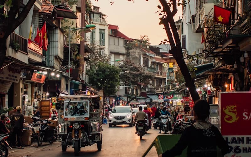
One practical note on getting around on foot: the downtown streets are narrow and packed with motorbikes, and crossing them feels alarming at first. The rule is simple — walk at a steady pace, don't stop and don't dart, and the flow parts around you. Sudden stops in the middle of the road are more dangerous than moving.
…remember the 3-second rule for the traffic lights… The traffic does not slow down during the 3-second yellow light… People will continue driving during the first 3 seconds of the red light… And they are likely to start moving 3 seconds before the light turns greenNgoc Vo, Lonely Planet, 2025
Where each district sits: the zones around the centre

For the character, prices and who each district suits, see the districts guide. Here it is navigation only: where the zone is on the map, how far it is, and why you would go.
| Zone | Where, relative to D1 | From the centre | Why go |
|---|---|---|---|
| District 3 | Northwest, adjacent | 2 km | Cafés, War Remnants Museum, quiet |
| Cholon (D5) | West | 5 km | Chinatown, Binh Tay Market, food |
| Binh Thanh | North, riverside | 4 km | Landmark 81, the promenade |
| Thao Dien (D2) | East, across the river | 7 km | Expat cafés, coworking |
| District 4 | South, over the bridge | 2 km | Seafood, street food |
| D7 (Phu My Hung) | Far south | 10 km | Malls, parks, expat scene |
Two zones trip up newcomers. Cholon (Chinatown) is to the west, spanning D5 and part of D6: the Chợ Bình Tây market, the Chùa Bà Thiên Hậu pagoda, the best Chinese-Vietnamese food in town. Thao Dien, by contrast, is to the east, across the river: the former District 2 and former Thu Duc City, since July 2025 part of An Khanh ward. People often use "D2" and "Thao Dien" interchangeably, though Thao Dien was just one ward of D2.
A word on Landmark 81: it stands in Binh Thanh on the north riverbank and works as a natural beacon. Lost your bearings after dark? Find the lit-up tower and you know where northeast and the river are.

Landmarks in the centre: what sits next to what

The main sights stand so close together that they string into a single walking route. What follows isn't a description of each one (that's the attractions guide) — it is how they sit relative to each other, so you can plan a sensible path.
| Landmark | District | From Ben Thanh | Hours |
|---|---|---|---|
| Notre-Dame Cathedral | D1 | 15-min walk | Outside 24/7 |
| Central Post Office | D1 | 15-min walk | 07:00–19:00 |
| Reunification Palace | D1 | 12-min walk | 07:00–18:00 |
| Bitexco Tower | D1 | 12-min walk | 09:30–21:30 |
| War Remnants Museum | D3 | 20-min walk | 07:30–17:30 |
| Jade Emperor Pagoda | D1 (north) | 10 min by Grab | 07:00–18:00 |
| Zoo / Botanical Gardens | D1 (north) | 10 min by Grab | 07:00–18:00 |
| Landmark 81 | Binh Thanh | 10–15 min by Grab | 09:00–22:00 |
Notre-Dame and the Post Office stand side by side on Công xã Paris square, in the northeast of D1. The cathedral has been under restoration since 2017 — check on the spot whether the interior is open; the exterior is what everyone photographs anyway; the Post Office is open, so step in for the antique wall maps. Reunification Palace is a couple of blocks west, right on the D3 border, where the War Remnants Museum is too.
A ready-made walking route: Ben Thanh → Notre-Dame → Post Office → Reunification Palace → down to the river for Bitexco and the promenade. All on foot, half a day with a stop for a bowl of phở bò. The Jade Emperor Pagoda, the zoo and the botanical gardens sit in the north of D1, about a kilometre apart — best tacked on as a separate short Grab hop.
The markets as reference points: Ben Thanh is dead centre in D1 (touristy, the city symbol), while Binh Tay is far to the west in Cholon — bigger, but with almost no tourists. Don't confuse them; they are at opposite ends of town.
Fast Track — no queue at the border
5–10 minutes instead of an hour in the immigration queue
from$11per passenger
Metro and getting between zones

On 22 December 2024 the city opened its first metro line. Line 1 runs from Bến Thành northeast along the river to Suối Tiên: 19.7 km, 14 stations (3 underground in the centre, 11 elevated). End to end is about 30 minutes. For navigation this matters — the line ties D1 to Binh Thanh and Thao Dien, skipping the bridges and the jams.
The three underground stations in the centre are useful markers:
- Ben Thanh (Bến Thành) — the start of the line, by the market
- Opera House (Nhà hát Thành phố) — by the pedestrian Nguyễn Huệ
- Ba Son (Ba Son) — by the waterfront
Past Ba Son the line rises onto a viaduct and heads northeast past Binh Thanh to the Thao Dien stations. Centre to Thao Dien by metro is about 15–20 minutes, versus 40–60 in a taxi at rush hour — it is the only reliable way across the river in the evening crush.
For everything else the metro won't help yet — it is a single line. The workhorse between zones is Grab (the local ride-hailing and delivery app). Drop a pin, see a fixed fare, no haggling. Here is roughly how long the hops actually take.
| Route | Distance | Off-peak / rush hour | Grab fare |
|---|---|---|---|
| D1 → D3 | 2 km | 5 / 10–15 min | from 25,000 VND (~$1) |
| D1 → Cholon (D5) | 5 km | 15 / 25–35 min | 40,000–60,000 VND (~$1.50–2.30) |
| D1 → Binh Thanh | 4 km | 10 / 20–30 min | 30,000–50,000 VND (~$1.20–1.90) |
| D1 → Thao Dien | 7 km | 15 / 30–45 min | 50,000–80,000 VND (~$1.90–3) |
| D1 → D7 | 10 km | 20 / 40–60 min | 60,000–100,000 VND (~$2.30–3.80) |
The full transport breakdown — Grab, buses, scooter rental, metro fares — is in the transport guide.
Offline maps and navigation: the practical bit

Google Maps works fully, with no VPN needed — that is your main map. Vietnamese addresses look odd, but the app copes. A few things worth setting up and knowing before you go.
- Grab's in-app map. Grab has its own map built in, so you never say the destination out loud — the driver sees the pin. That is the single biggest hack for taxis here.
- Backup maps. Organic Maps or Maps.me are fully offline, installed in advance — handy if Google won't load for some reason.
- Save your pins. Before heading out, star your hotel and a couple of anchors (Ben Thanh, Notre-Dame) so you can quickly re-plot a route.
…just open the wi-fi networks list on your phone, walk in to the nearest provider and ask for the wi-fi password… ask a random (preferably young) person and they will likely be willing to share their hot spot with you so you can make a quick payment or check your onwards routeNgoc Vo, Lonely Planet, 2025
House numbering. 14, 14A, 14B, 14/1 and 14/2 are five different buildings. Slashes and letters are normal Vietnamese addressing, and Google Maps knows every one — don't try to hunt down "just number 14".
Giving an address to a driver. A foreigner attempting Vietnamese street names tends to produce something between confusion and laughter. Just show the pin on your screen — in Grab or to a regular taxi.
Streets worth memorising in D1:
- Đồng Khởi — the showpiece, from the cathedral to the river
- Nguyễn Huệ — pedestrian, from City Hall to the river
- Lê Lợi — from Ben Thanh into the centre
- Bùi Viện — backpacker, bars
- Hai Bà Trưng — a long artery through D1 and D3
Time of day. From 11:00 to 15:00 it is +32–35°C with 70–85% humidity — walk the landmarks early (before 10:00) or towards sunset (after 16:30). At midday, hide in a café or a mall.
Airport to the centre
Tân Sơn Nhất airport is a rare case: it sits right inside the city, to the northwest, 7–8 km from central D1. Nothing like Cam Ranh, 35 km from Nha Trang — here you are 20–40 minutes from your hotel.
- Grab is the easy option: 80,000–150,000 VND (~$3–6), 20–40 minutes depending on traffic. Find the pickup point by the Grab / ride-hailing signs on the way out.
- Vinasun / Mai Linh taxis are the official metered ones, about the same money. Take them from the rank, not from touts in the hall.
- Bus 109 runs to Ben Thanh for 15,000 VND (~$0.60) if you are travelling light and in no rush.
At rush hour the airport run easily doubles: leave a buffer if you have a connection or a fixed hotel check-in.
FAQ
The tourist core is District 1, on the west bank of the Saigon River, with Ben Thanh Market as the main anchor. Going around: District 3 sits to the northwest, Cholon (D5) to the west, Binh Thanh with Landmark 81 to the north, Thao Dien (formerly D2) to the east across the river, D4 just to the south, D7 (Phu My Hung) far to the south, and the airport to the northwest. Most of your time will be spent in D1.
Yes. The key landmarks of District 1 fit inside a square of roughly 2×2 km. Ben Thanh to Notre-Dame is a 15-minute walk, the cathedral to Reunification Palace about 12, and from there down to Bitexco Tower and the riverfront another 12 or so. You can cover the whole centre on foot in half a day.
Yes — Line 1 has run since 22 December 2024, the first metro in the city. It covers 19.7 km from Ben Thanh northeast to Suoi Tien, with 14 stations (3 underground in the centre — Ben Thanh, Opera House, Ba Son — and 11 elevated). End to end is about 30 minutes. It is useful for reaching Binh Thanh and Thao Dien while avoiding the traffic.
Google Maps works fully, with no VPN needed. Download the offline map of Ho Chi Minh City before you land — data can drop in underpasses, malls and the metro. Grab has its own in-app map, so you show the driver the pin rather than pronouncing an address. As a backup, install Organic Maps or Maps.me.
Tan Son Nhat airport sits right inside the city — 7–8 km from District 1
- A Grab80,000–150,000 VND~$3–6runs and takes 20–40 minutes depending on traffic
- A Vinasun or Mai Linh taxiabout the same
- Bus 109 to Ben Thanh15,000 VND~$0.60goes for
District 1 for a first visit of 3–7 days: everything is walkable and the landmarks are close by, with nightlife on Bui Vien. For quiet, neighbouring District 3 offers the same distances without the bar noise. Families lean to D7 (Phu My Hung); remote workers to Thao Dien, which has the metro. A full breakdown is in the districts guide.
- Guide
Ho Chi Minh City vs Hanoi for Living 2026: Costs, Climate
Living in Ho Chi Minh City or Hanoi in 2026: monthly costs and rent, climate by season, the new metro, coworking and remote work. A verdict for 14 profiles.Ho Chi Minh City vs Hanoi for Living 2026: Costs, Climate - Guide
Where to Stay in Ho Chi Minh City 2026: Districts
Saigon neighbourhoods: District 1, District 3, Chinatown (D5), Binh Thanh and Thao Dien — where tourists, expats and nomads stay, plus renting.Where to Stay in Ho Chi Minh City 2026: Districts - Guide
Ho Chi Minh City Attractions 2026: What to See
Saigon attractions: the War Remnants Museum, Independence Palace, Notre-Dame, Ben Thanh, Bitexco and the Cu Chi Tunnels — tickets and itineraries.Ho Chi Minh City Attractions 2026: What to See